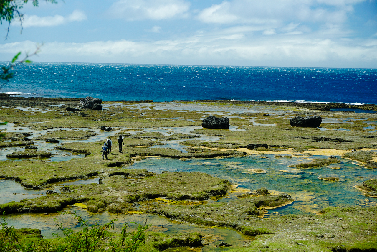
Massive boulders, some as heavy as a truck, scattered across a rocky coastal area in Pasuquin, Ilocos Norte, have unlocked secrets of powerful waves that shaped the coastline centuries ago. A team of researchers from the University of the Philippines and international collaborators revealed that these boulders, now sitting far from the sea, were hurled inland by extreme waves—likely tsunamis or intense storms. Their study offers new insights into coastal hazards and could help communities prepare for future disasters.
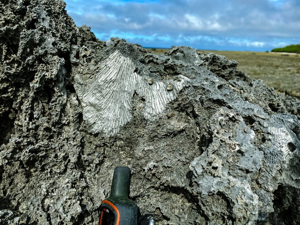
The boulders, found in Barangays Davila and Dilavo, are fragments of an ancient coral reef. Edrian Tubalado, a lead researcher from the University of the Philippines – Diliman College of Science National Institute of Geological Sciences, explained that some boulders weigh up to 31 tons. “We measured their size, weight, and location, and used specialized dating techniques to determine the ages of the coral components. These ages tell us when the coral boulders were moved out of the sea and onto the coast,” he said.
The research team, including scientists from Germany, Taiwan, and the Philippines, studied 198 boulders. By analyzing their positions and ages, they reconstructed past extreme wave events. These waves, which occurred hundreds to thousands of years ago, were powerful enough to reshape coastlines. “Unlike sand, which washes away, these massive boulders stay put unless another extreme wave moves them. This makes them a long-term record of rare but destructive events,” Tubalado added.
In the Philippines, where written records of coastal disasters span only a few centuries, such findings fill critical gaps. The study estimates that waves in Pasuquin could have reached up to 4 meters high. By identifying past events, the team can now estimate potential future wave intensity and advise on preparedness.
The research also highlighted which areas face the greatest risks. Coastal indentations, called embayments, and regions with steep underwater slopes showed more boulder deposits. “This helps us pinpoint the most vulnerable zones,” Tubalado said. As climate change boosts the intensity of storms, understanding these risks becomes vital for disaster planning.
The study, published in the journal Marine Geology, underscores the importance of “geological memory” in predicting future hazards. It suggests that local governments can use this data to improve evacuation routes, strengthen building codes, and design resilient infrastructure. For example, communities now know that areas near embayments may require higher seawalls or steeper evacuation paths.
Collaborators from the Leibniz Centre for Tropical Marine Research, National Taiwan University, and other institutions used advanced coral dating techniques at the HISPEC Laboratory in Taiwan. The project was supported by the Department of Science and Technology (DOST) and other grants focused on tsunami and climate risk research.
Tubalado emphasized the broader implications. “As tropical cyclones grow stronger, understanding our history with extreme waves is no longer optional. It’s essential for survival. These boulders aren’t just rocks—they’re time capsules warning us of the past and preparing us for the future.”
The research team now plans to expand their work to other Philippine coasts, aiming to create a comprehensive map of historical wave risks. For now, the giant boulders in Pasuquin stand as silent sentinels—a reminder of the ocean’s power and humanity’s ability to learn from it.
Keywords: Philippines, Ilocos Norte, Pasuquin, coastal boulders, extreme waves, tsunamis, storms, geological research, University of the Philippines, coastal hazards, climate change, hazard preparedness, marine geology, fossil corals, coastal resilience.