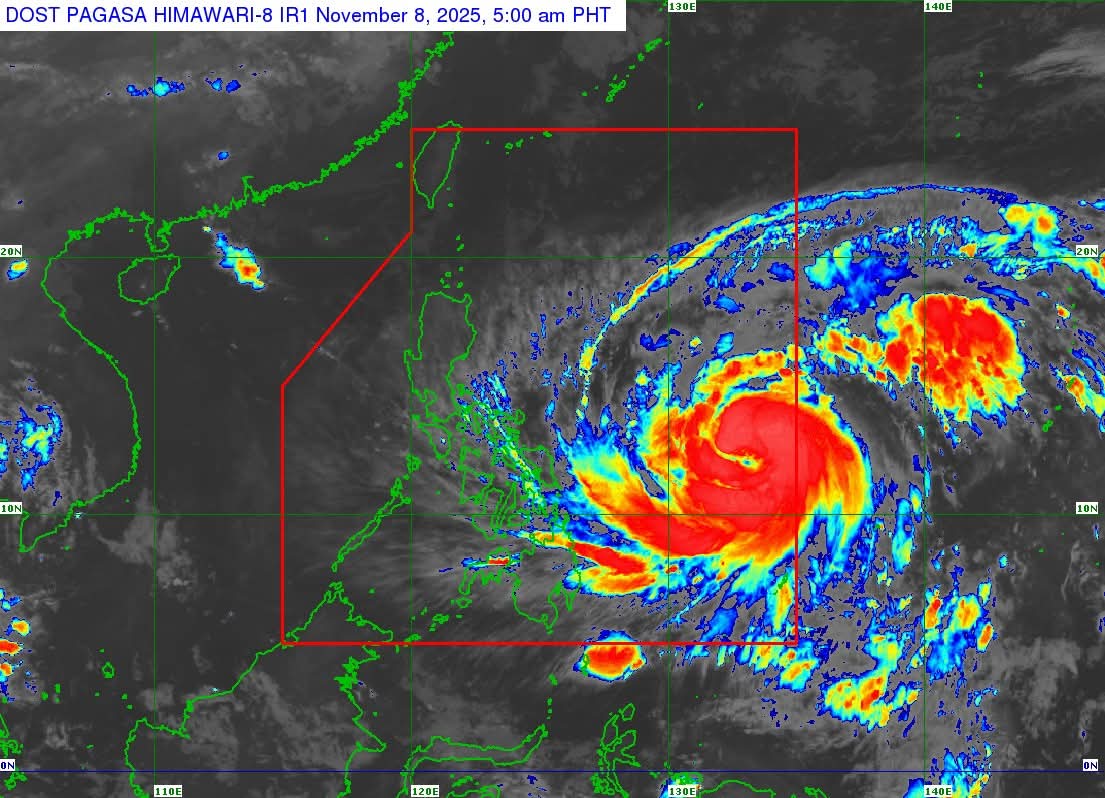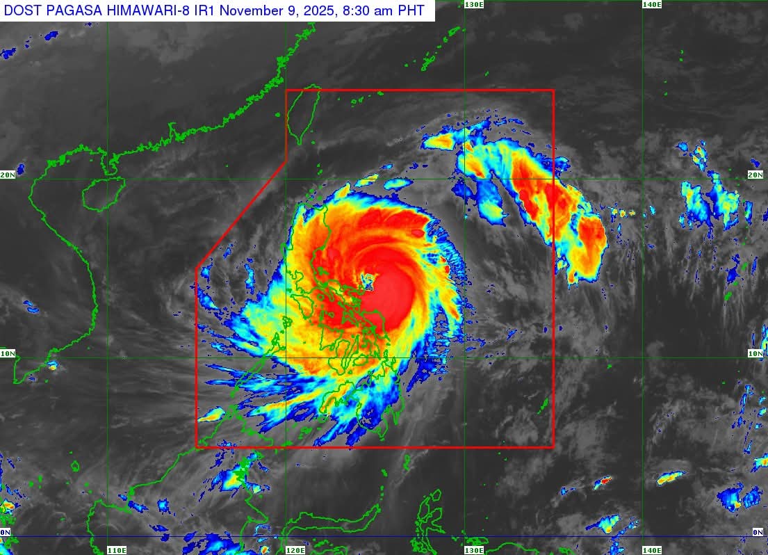
Super Typhoon UWAN (FUNG-WONG) has intensified into a super typhoon. Life-threatening conditions are now being experienced in Catanduanes. As of 8:00 AM today, November 9, 2025, the typhoon’s eye was located 125 km East Northeast of Virac, Catanduanes.

UWAN packs maximum sustained winds of 185 km/h near its center. Gustiness can reach up to 230 km/h. Its central pressure is 935 hPa. The super typhoon is moving west northwestward at 25 km/h. Strong to typhoon-force winds extend outwards up to 800 km from the center.
Tropical Cyclone Wind Signal (TCWS) No. 5 is in effect. This signals typhoon-force winds. Areas under TCWS No. 5 include Polillo Islands, northern Camarines Norte, eastern Camarines Sur, and Catanduanes. Residents in these areas face an extreme threat to life and property.

UWAN may pass close to Catanduanes this morning. A direct hit or landfall scenario over Catanduanes is possible. It is forecast to make landfall over Aurora tonight or early Monday morning. The typhoon is expected to be at or near its peak intensity during landfall. UWAN will weaken significantly after interacting with terrain. However, it will remain a typhoon during its passage over Northern Luzon.
A high risk of life-threatening storm surge exists. Peak heights exceeding 3.0 meters are expected. This is within the next 48 hours for many coastal communities. These include Cagayan, Isabela, Ilocos Norte, and Metro Manila. Dangerous sea conditions prevail in several seaboards. A Gale Warning is in effect. Sea travel is risky for all types of vessels. Mariners must remain in port for safety.
Authorities urge the public to stay informed. Please take all necessary precautions. Be prepared for severe winds, heavy rainfall, and coastal flooding.