
The Philippine Space Agency (PhilSA) is using satellite technology to track the impact of Typhoon Inday. Heavy rains from the storm’s enhanced Southwest Monsoon recently caused flooding and landslides across the country.
PhilSA released new maps to help officials respond to the disaster. These maps pinpoint flooded regions and landslide zones.
Detailed Satellite Imagery
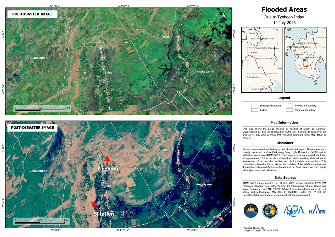
PhilSA used high-resolution images to study flooding in Cotabato and Maguindanao del Sur. The agency analyzed data from the KOMPSAT-3 satellite, provided by the Korea Aerospace Research Institute. The images were captured on July 14.
“These flooded area maps are based solely on visual interpretation of satellite imagery and remain subject to ground validation,” PhilSA stated.
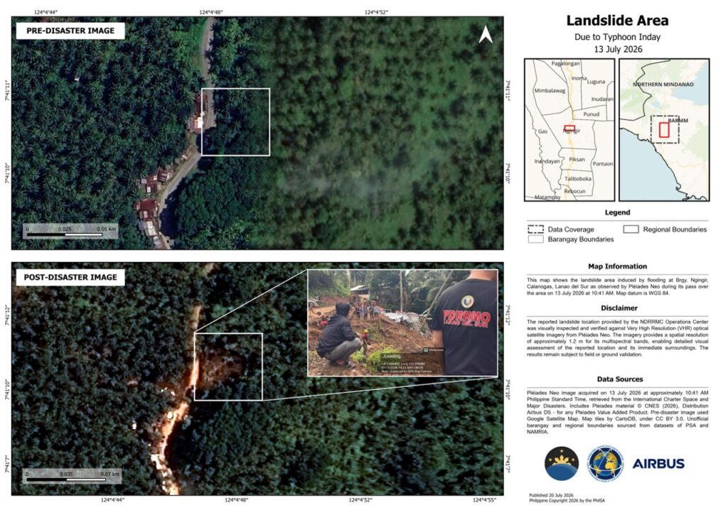
In Lanao del Sur, the agency mapped a landslide in Barangay Ngingir, Calanogas. Analysts used optical satellite imagery from the Airbus Pléiades Neo constellation. An inspection confirmed the landslide site reported by the National Disaster Risk Reduction and Management Council (NDRRMC) Operations Center.
Radar Technology for Flood Monitoring
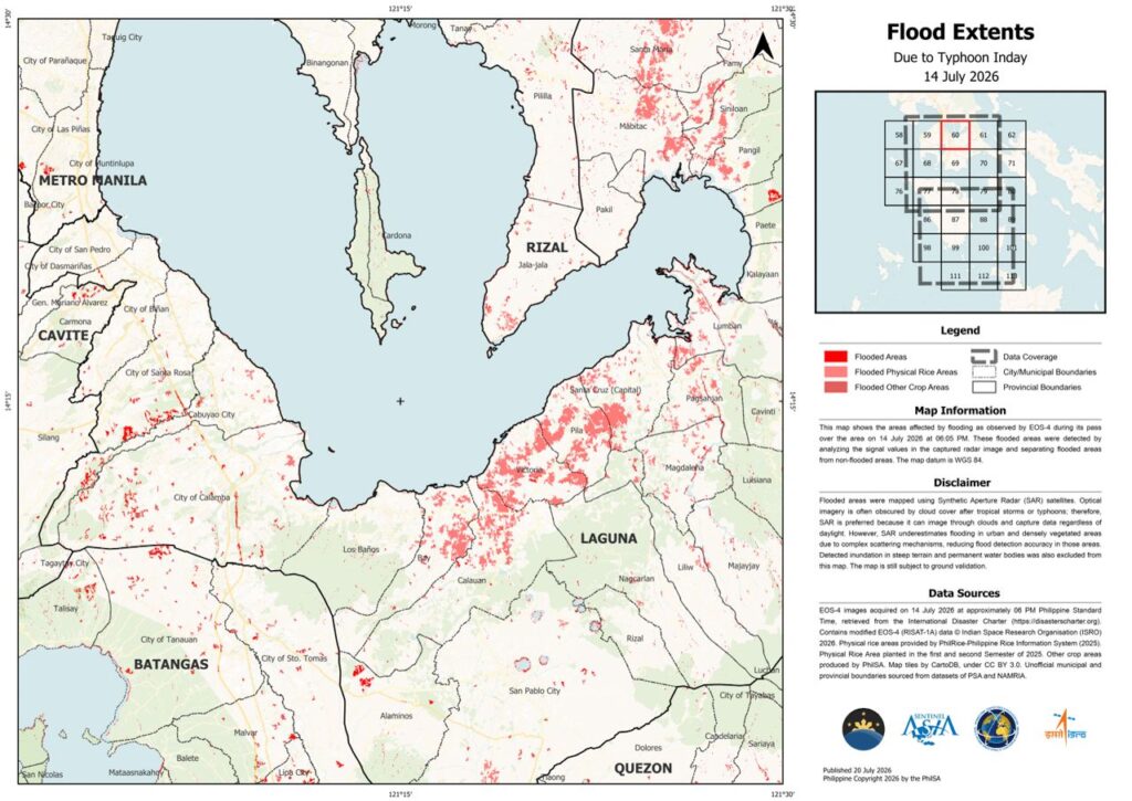
PhilSA also mapped floods in the CALABARZON and MIMAROPA regions. These maps utilized Synthetic Aperture Radar (SAR) data. The agency processed images from the Indian Space Research Organisation’s EOS-4 satellite captured on July 14.
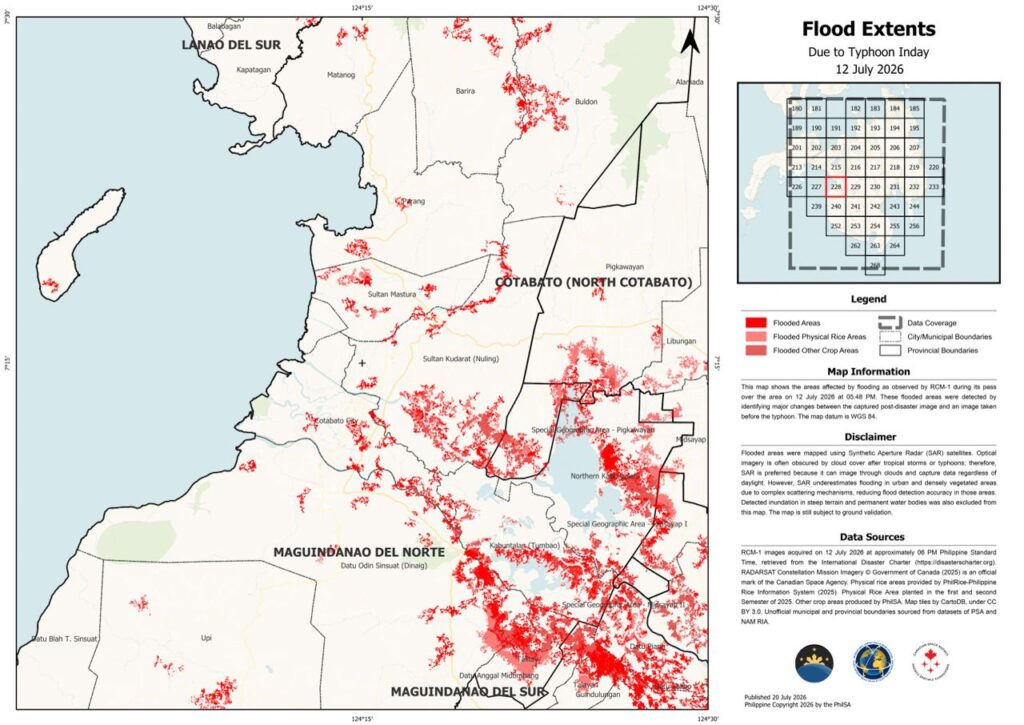
SAR technology is vital for disaster response. The signals can penetrate thick clouds that often hide storm damage. They also work regardless of daylight. However, the agency noted that radar data can sometimes lose accuracy in urban or heavily forested areas.
PhilSA also processed radar data from a Canadian Space Agency satellite to study Mindanao. That image was captured on July 12.
Global Space Cooperation
PhilSA’s rapid response is part of several international partnerships. The agency works with space organizations in Korea, France, India, Canada, and Europe.
These collaborations include Sentinel Asia, a project led by Japan and the Asian Disaster Reduction Center. PhilSA also works with the International Charter: Space and Major Disasters. This global network provides critical satellite imagery during emergencies.
Local access to data is also improving. The CopPhil program established a mirror site for Copernicus data. This provides free, immediate access to satellite information for disaster management, agriculture, and environmental monitoring.
Supporting Disaster Response
PhilSA continues to work closely with the NDRRMC. The agency provides wide-area satellite maps to help leaders prioritize relief efforts.
“By making space data accessible to stakeholders, PhilSA enables informed decision-making and strengthens disaster response,” the agency said.
Authorities are using these maps to guide rescue and recovery operations on the ground. PhilSA reminds residents that all satellite-generated maps require ground validation to ensure complete accuracy.